Like most years, my boys and I went on a backpacking trip over spring break. This year we were either going to the Spruce Knob area or to Dolly Sods. Both of these places offer alpine-like highlands that we are not used to seeing in Ohio. Weather would determine the location. The weather at Dolly Sods was forecast to be slightly colder with a slightly higher chance or rain, so they decided to go to Spruce Knob.
We were originally going to leave Akron on Wednesday after work, but we couldn’t make it work. It’s just as well, the drive to Spruce Knob is about five and a half hours. And, the last portion follows a winding, guardrail-less one and a half lane road up the side of the mountain. So not arriving after dark was probably for the best.
We left early Thursday morning. We had plenty of podcasts downloaded for the long drive, so it wasn’t obvious when we lost cell service, but it was somewhere along US Route 33. We noticed the lack of service once we reached The Gateway Restaurant for lunch. Maybe it was because of entering the outermost range of the National Radio Quiet Zone, maybe it was just due to the mountainous terrain, or maybe it was simply a Verizon dead zone.
Regardless of the reason, it meant that we could not look up directions from the restaurant to the trailhead. I knew that we would probably loose cellular service as we got close to our destination, so I had printed directions. Unfortunately, I didn’t notice that my turn was the road directly before the restaurant. So, we wasted some time following US33 a little further east than we should have. After identifying my error we turner around and headed back toward the trailhead.
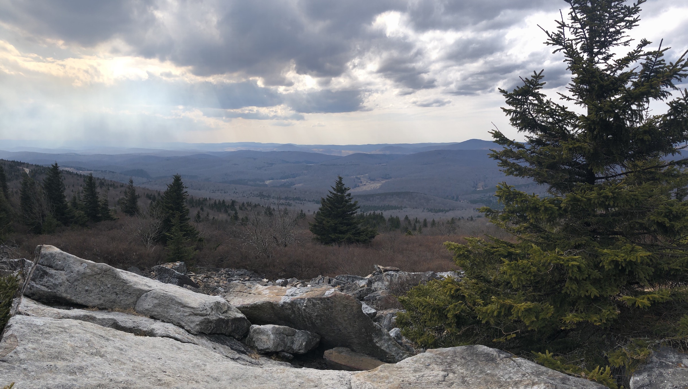
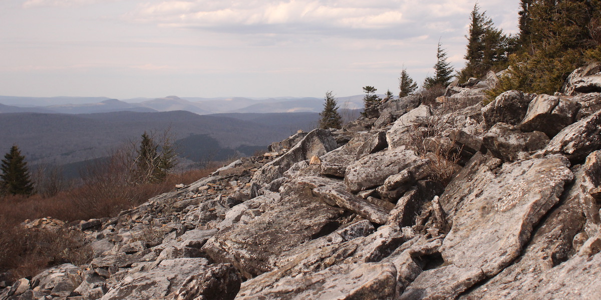
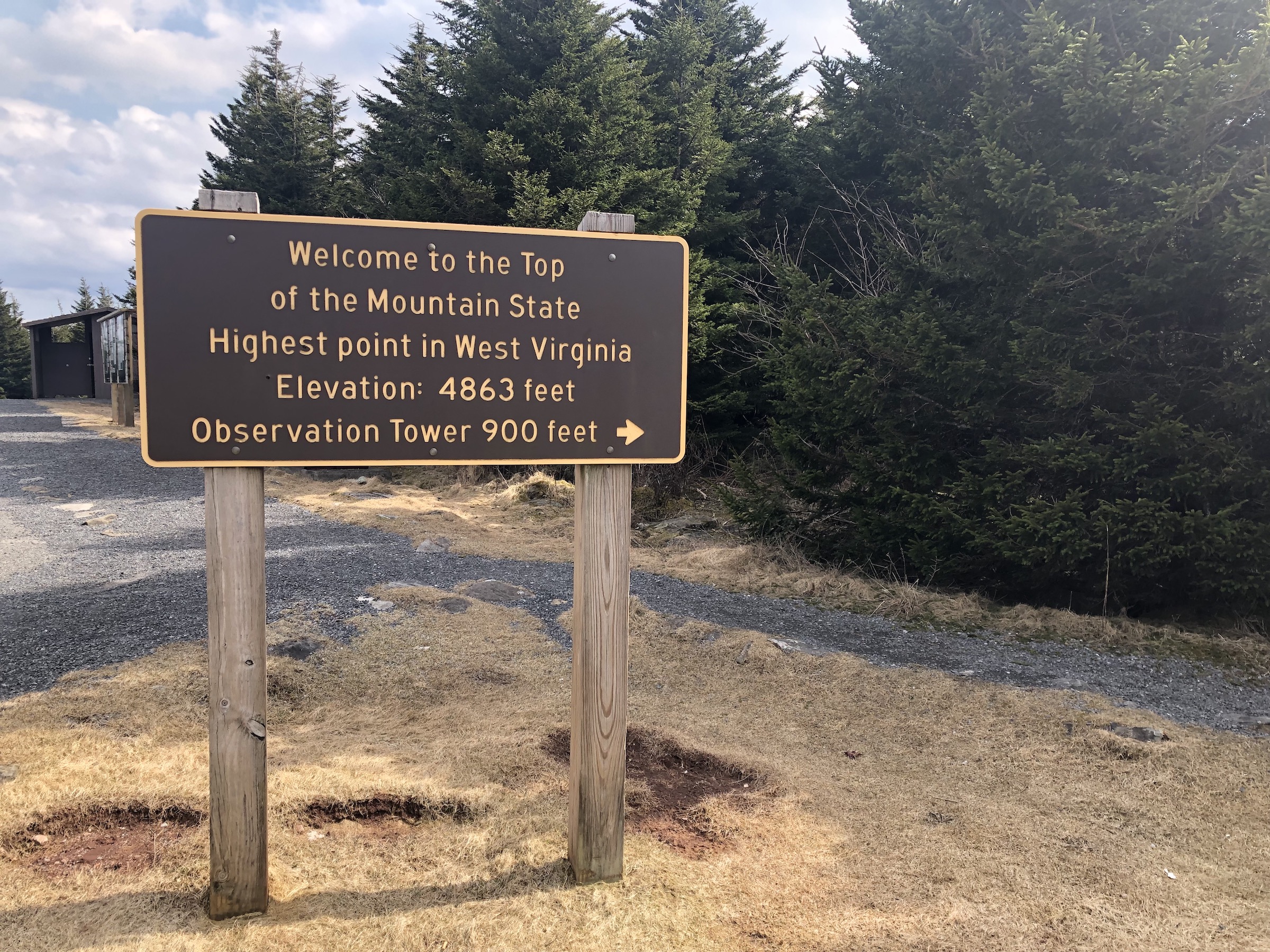
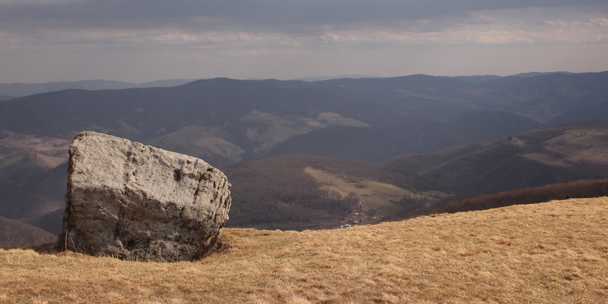
On the drive the temperature had steadily increased, at least until we started ascending the mountain. On top of Spruce Knob it was cool and breezy, but not bad for a spring day. The terrain was unlike what we were used to. There were large conglomerate boulders, groves of red spruce, and grassy meadows.
The view from the top of Spruce Knob was amazing. There is a two-story tower which provides additional height to see over all of the trees; the summit is full of evergreens. However, hiking the trail out past the spruce surrounding the tower yielded much better views.
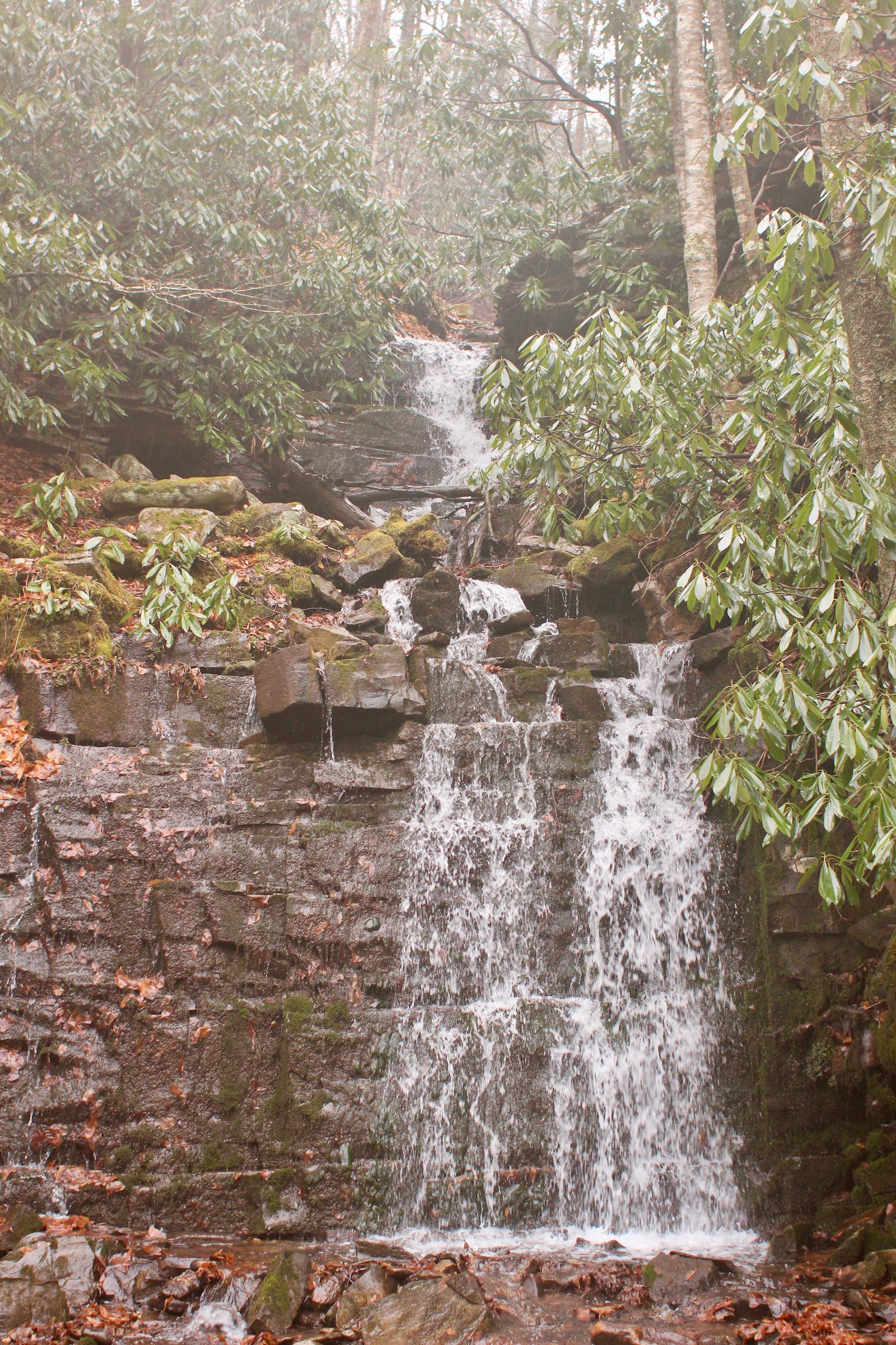
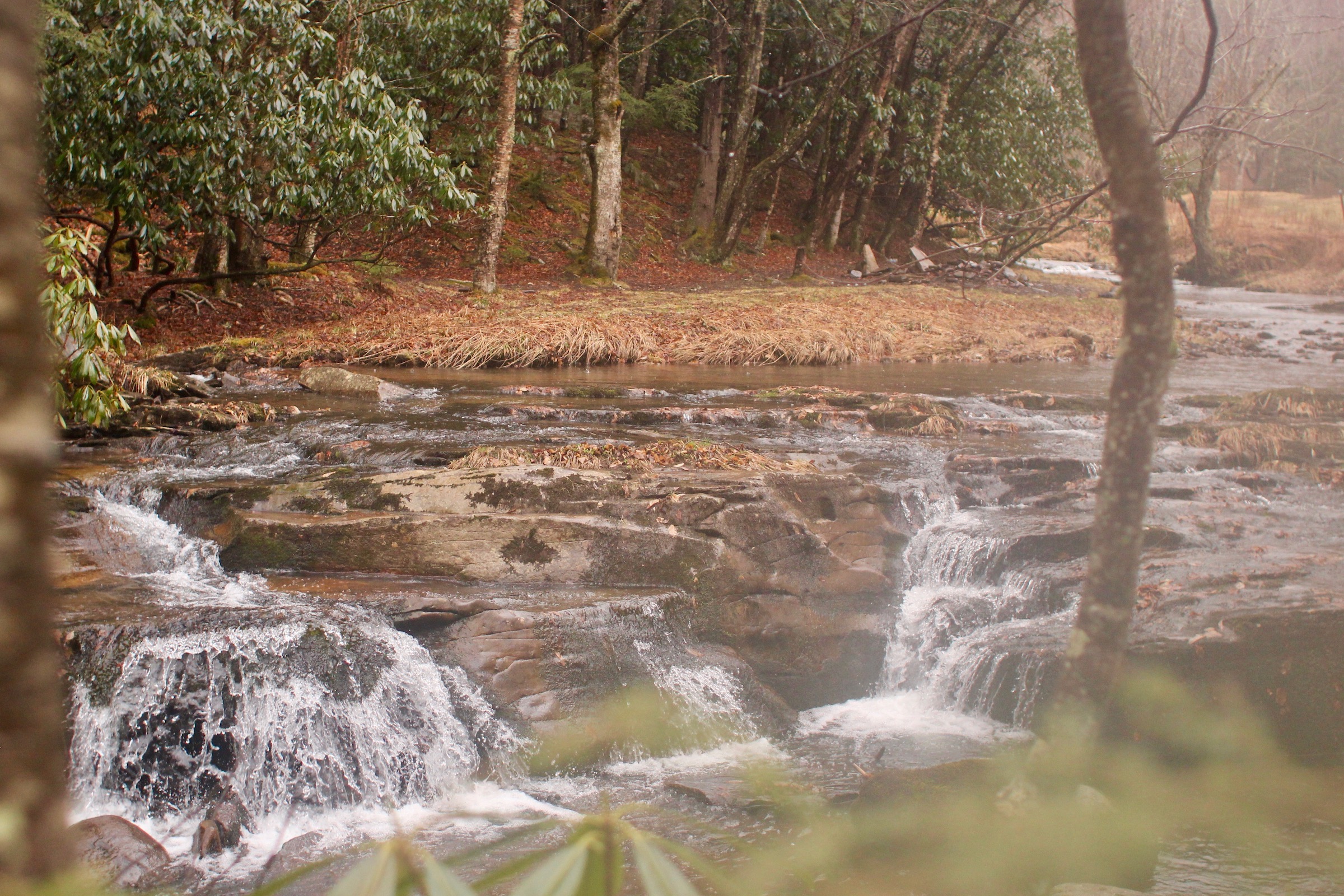
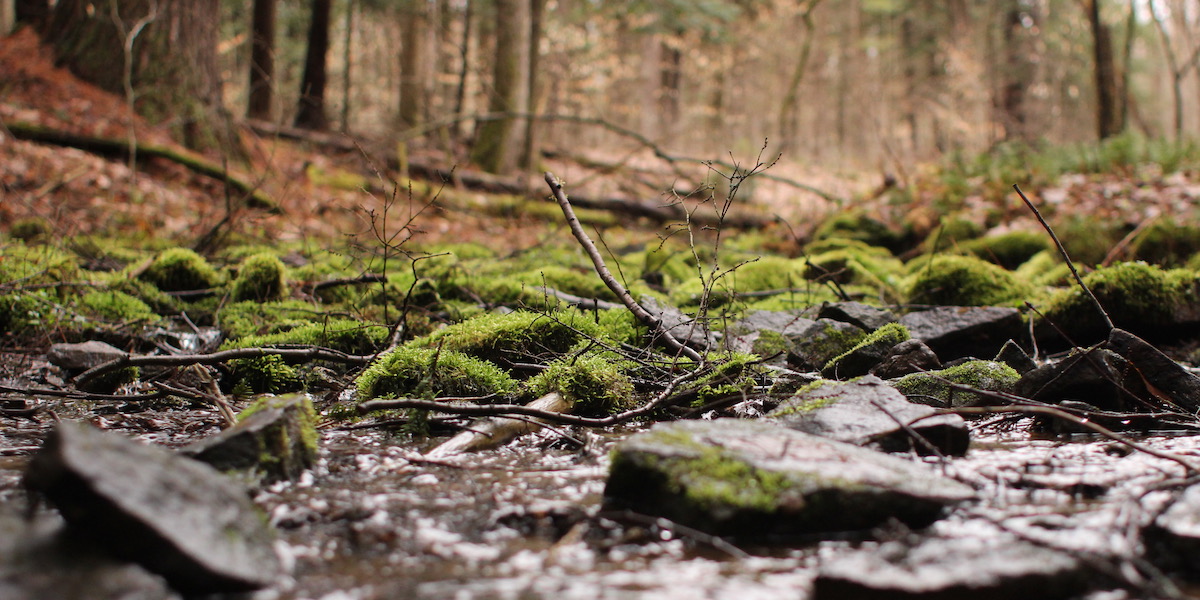
After exploring the summit we grabbed our packs and headed out on the Huckleberry trail (trail 533). The first four miles were relatively flat, just a modest downhill grade. The last mile or so headed downhill and the ecology changed to deciduous forest. By this time it was getting late in the day, so we wanted to find water and make camp for the night. We could hear water in the distance and thought that following the Judy Springs trail (trail 512) would likely lead us to water. The trail cut across a grassy meadow, but was still steep. At the edge of the meadow was Judy Springs, which is where we camped.
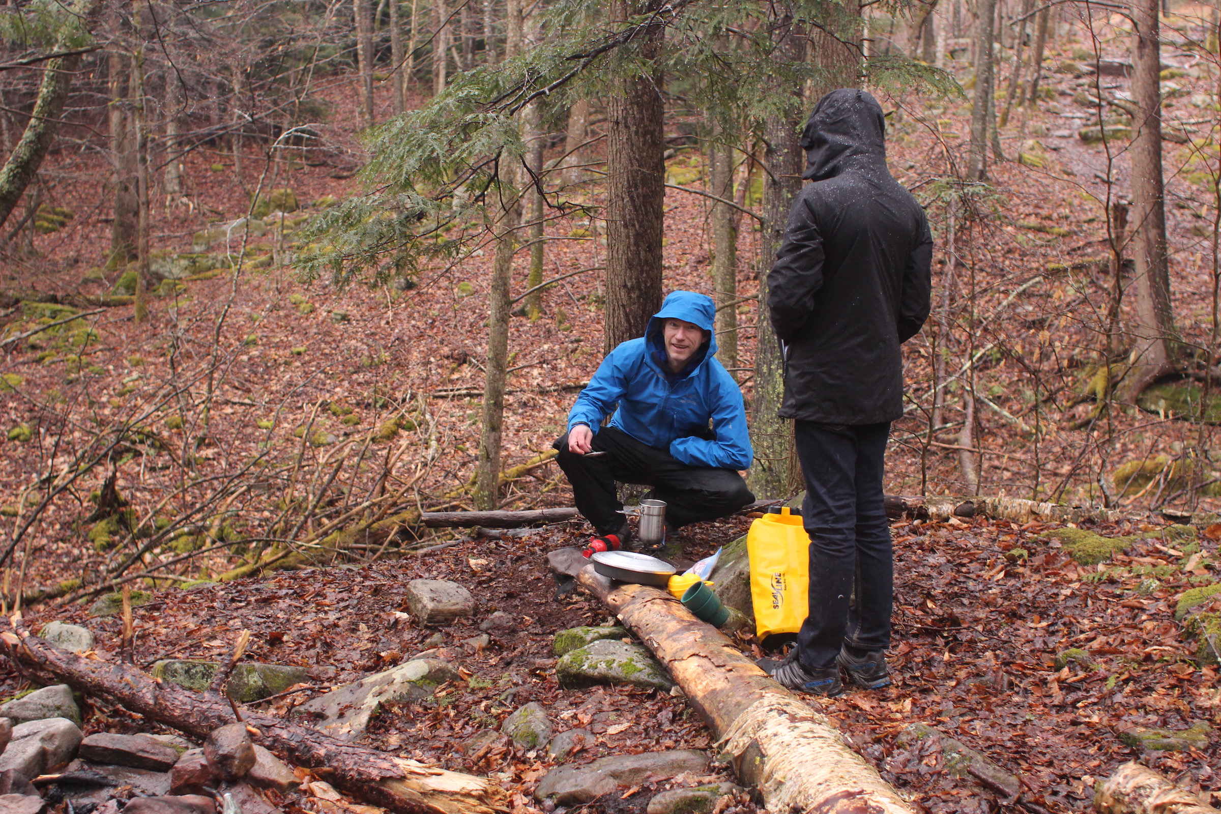
Sometime after dark it started raining. We were expecting rain, but the forecast said that it would not start until the late morning. We made breakfast, cleaned up, filtered enough water for our travels, and waited for the rain to let up so that we could take down our tents. It kept raining. So, we tried to pack up our tents and keep them as dry as possible. The boys were able to take the body of the Marmot Limelight down under the fly, keeping it dry. I had no such luck with the SlingFin 2Lite.
With all of our gear packed we continued down the Judy Springs trail. There is a wooden bridge which crosses Seneca Creek and leads to the Seneca Creek trail (trail 515). There were many people camped along this trail. We followed the trail northeast, until it crossed the creek. The creek crossing was probably twenty feet across and up to a foot and a half deep. There were better places to cross a little further downstream, but we decided against crossing.
We backtracked to the Judy Springs trail and then continued up it’s steep slope. We crossed Judy Springs and the grassy meadow again; it was much, much harder this time. It was almost noon, it was still raining, and thunderstorms seemed possible. We wanted to get across the meadow as quickly as possible. It was quite a workout.
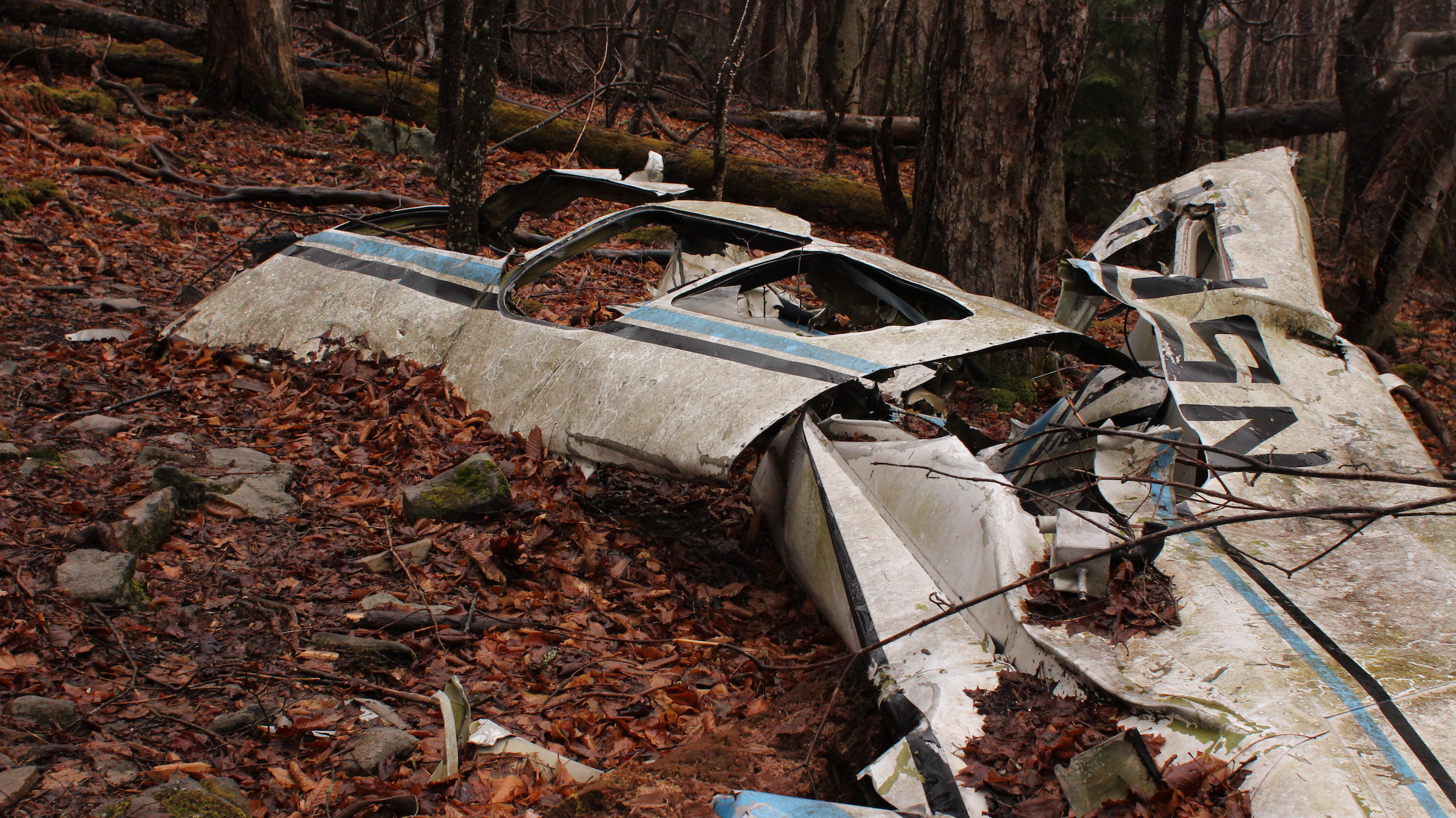
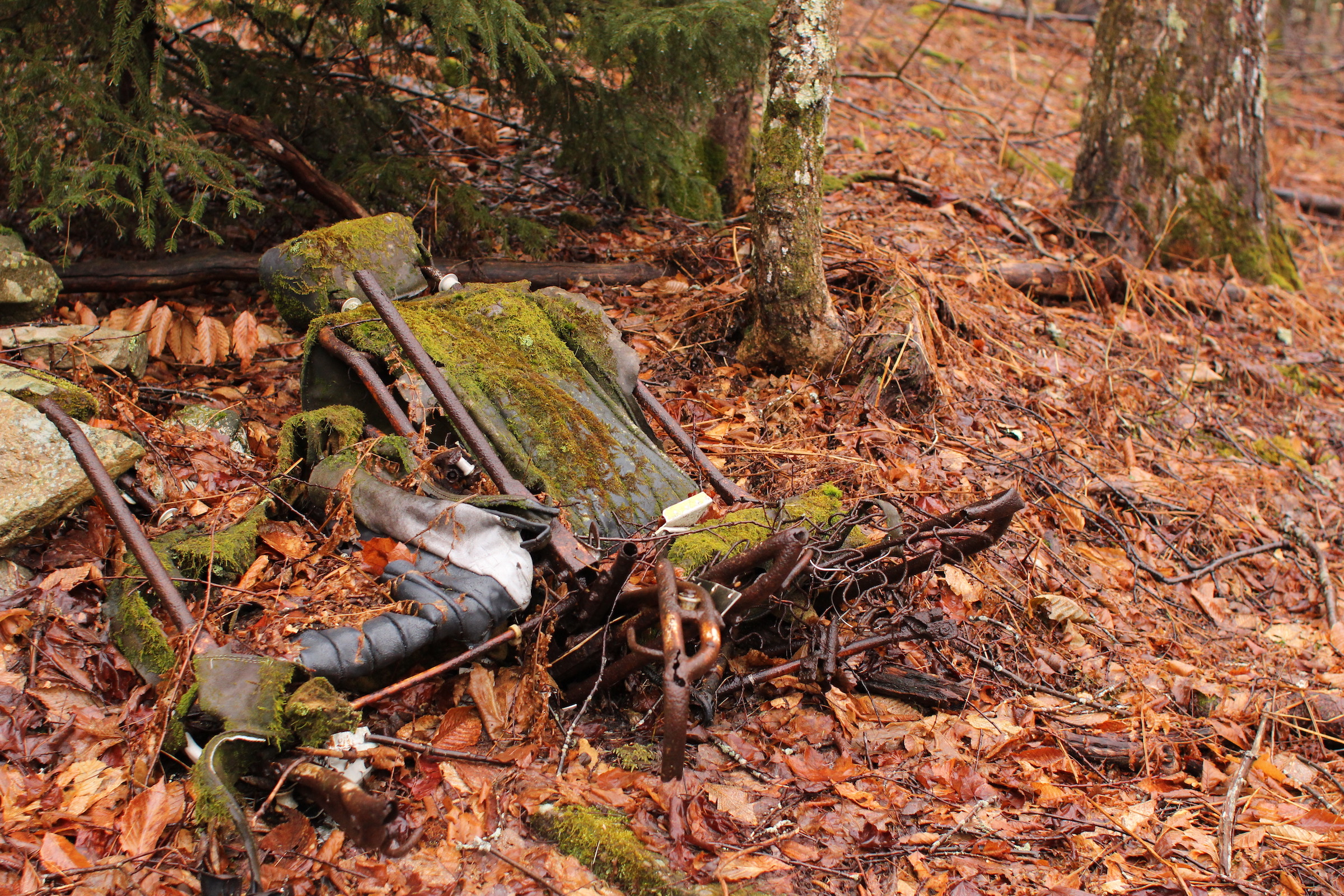
We made it to the Lumberjack trail (trail 534), and decided to head north in search of the remains of a crashed small airplane. The plane crashed due to bad weather on October 31, 1973. Both of its occupants were killed. Fergus and Henri has an excellent article explaining what is known about the crash.
The wind seemed to pick up and howl louder through the treetops as we got closer to the crash site. This trail is known to be muddy, and it was doubly so on this rainy day. We arrived at the site, but didn’t stay long. It was strange and eerie seeing an airplane turned inside out and spread across the forest.
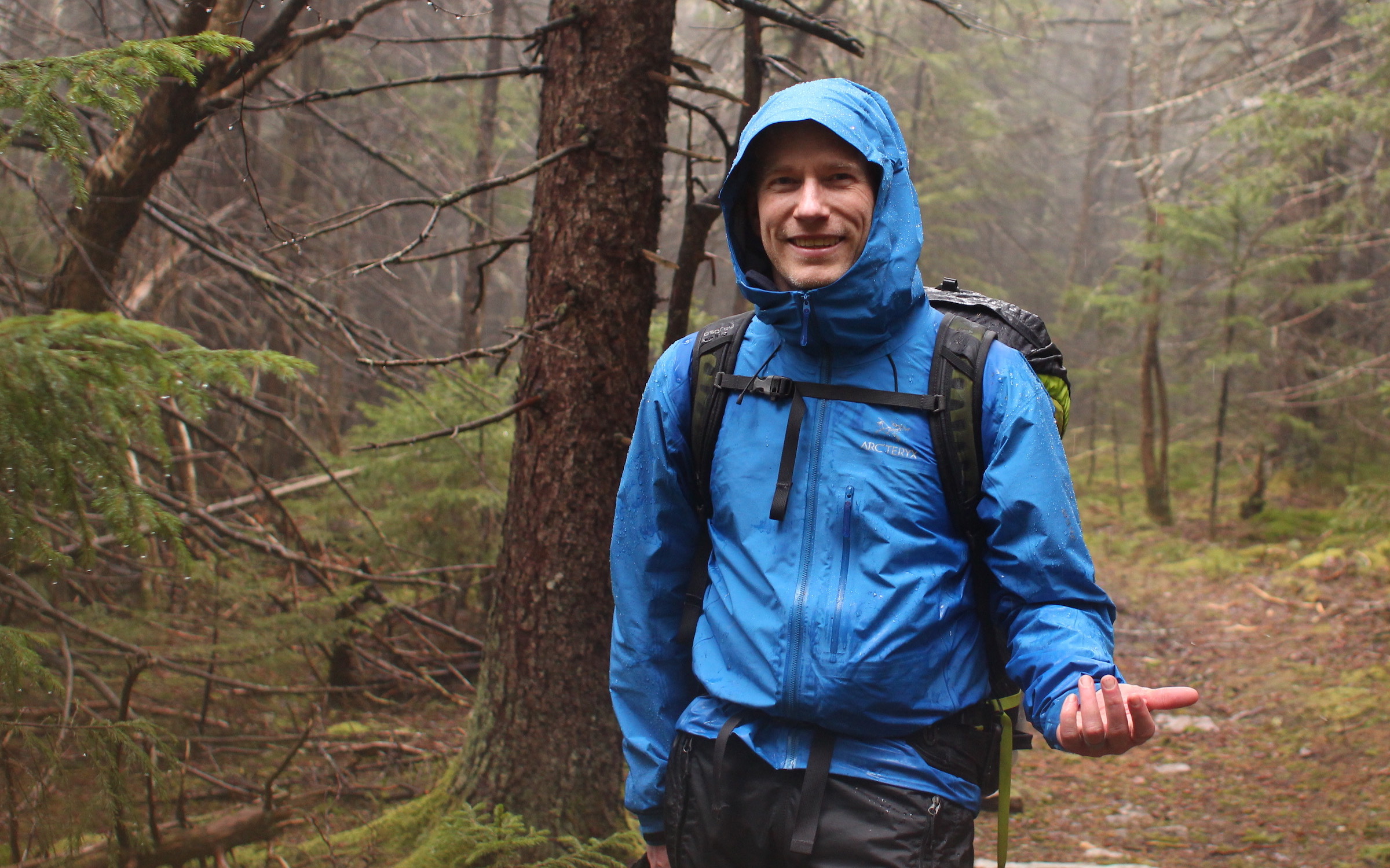
As we reached the Huckleberry trail again we stopped to eat lunch and dry our feet. It had been raining so consistently that our rain gear was starting to wet out. We decided to head back to the trailhead early. There is a small pavilion near the summit where we could get out of the rain and make dinner.
Once we got there and stopped moving we got chilled very quickly. It was forty degrees and windy. We decided to make a hot beverage and the cinnamon rolls which we had planned for dinner. It was five o’clock. Rather than camping for the night and heading home in the morning, we decided to cut our trip short and head home.
If we were to do the trip again, we’d probably visit Spruce Knob and then drive down to the Seneca Creek trailhead. We’d skip visiting the crashed airplane, avoid the muddy Lumberjack trail, and cut out the steep down and uphill hiking. We didn’t see any reliable water sources higher up the mountain, so we had to haul it up. That added to the weight we had to carry uphill. The hike we hiked was harder than it needed to be; next time we visit the Spruce Knob Seneca Creek area we might opt for an easier hike.